
Kot in Krma
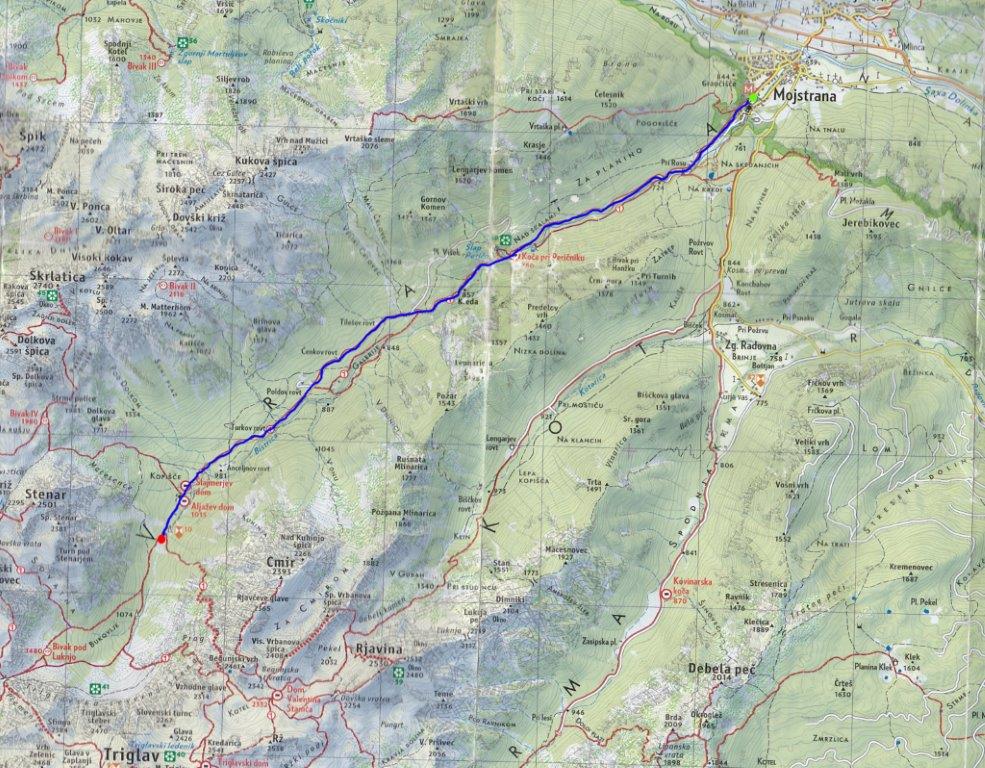
Mojstrana - Peričnik - Vrata - Mojstrana
The trail starts from the car park in front of the Slovenian Alpine Museum. Turn left in the direction of Vrata. After 300m bear right, uphill, and pass the small hydroelectric plant at "Rosu". Continue 300m ahead and again bear right uphill - 1.75km. The tarmac slowly gives way to a dirt road; follow it all the way to Peričnik Waterfall. On the left-hand side of the road is the Peričnik snack bar - 4km, 752m. Continue a few metres to the bridge for a beautiful view of the lower Peričnik waterfall, which is 52m high. Above this waterfall is another higher one, but you can’t see it from the road. Walking trails climb up to both waterfalls.
From Peričnik the road climbs gently at first, but after 400m is the steepest part of the ascent on the tour, which is 1.6km long, 190m. The climb is mostly on tarmac road, and the flatter parts are unmade. After a steep climb, the road again climbs gently and continues as a gravel road. On the final climb, just before the car park at Vrata, it becomes tarmac again. At the end of the Vrata car park, it is still 200m to the Aljažev dom (mountain hut) – 9.6km, 1,015m.
From the dom continue along the forest road. After 450m there is a rock with a big peg and karabiner mounted in it (a memorial to fallen climbers). From here there is a spectacular view of the North Face of Triglav – 10.1km, 1,020m.
From the viewpoint turn back to Mojstrana and follow the road all the way to the starting point - 20.2km.
WARNING: The road to Vrata is very busy during the peak mountaineering season (July and August), so take care.
Length: 20 km
Total time: 1.5-3h
Difficulty of route: Difficult
Starting point: Slovenian Alpine Museum, 650m. Coordinates WGS 84: N: 46°27'28''; E: 13° 56'9''
Midpoint: Bar at Peričnik Waterfall: 752m. Coordinates WGS 84: N: 46°26'18''; E: 13°53'46''
Highest point: Viewpoint at the memorial 1,020m. Coordinates: WGS-84: N: 46°24'19'' E: 13° 50'28''
End point: Slovenian Alpine Museum.
Height difference: 370m
Source: Map of the Julian Alps 1: 50,000 published by Sidarta


